On another day,I set out with Christine to investigate some information she had heard.Someone had told her that while walking their dog that they had found some track still in place.I was sceptical of this,as I know that all the track was lifted after the station was closed,but I was happy to go and investigate just in case.There was only one place that I could think of where we hadn't really looked before and that was along where the line went behind the industrial site,so that's where we went.
There is a road that runs to the right of where the raised track bed used to run,so we walked down that to see what was there.Most of the track bed here has been destroyed by the industrial units that are now on it,but you can still envisage how it once was.At the bottom of the road is a now unused gas storage depot and as we reached it, I thought that was the end of that,but we continued walking to the left of the depot and were soon pleased that we had.
As we turned a corner,there in front of us was a lovely little bridge and also the raised track bed.Not only was I amazed to find this,but also I was a bit annoyed that I had missed it on the map.I'm usually very thorough when studying maps and often spend hours looking at them,but it just goes to show you that however thorough you are,you can always miss something.


The bridge itself is of the same high quality that we usually find along the line and is still in good condition.It was obviously made,like many in rural Devon,to connect two farmer's fields so that livestock could be moved under the railway.
Looking around we also found the remains of where an old signal had been.When the railway was dismantled,they just cut things off at ground level rather than excavating properly.We decided to investigate further and set off down the line to see what else we might find.
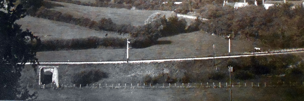
This old picture from 1909 shows the bridge as it was.Notice that thebrick wall and safety rail isn't there.I believe the remains of the signal we found is the first one to the right of the bridge.
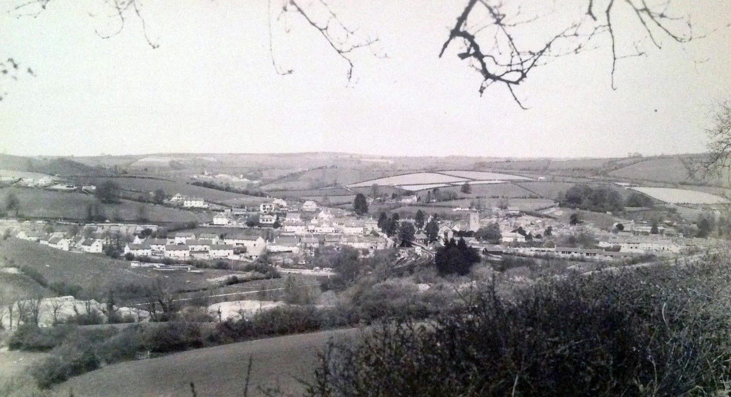
In this old postcard the section of line we walked is the white line seen in the bottom left.
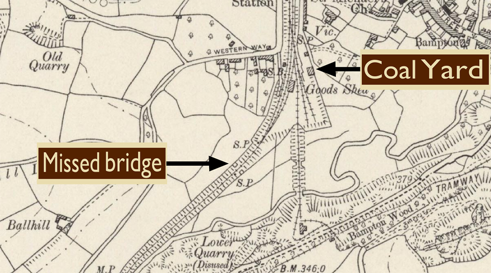
This 1904 map shows the Coal Yard and the bridge I had missed.It's only marked by two small "teeth" and that's probably why I missed it,that's my excuse anyway.